Kyiv north-western suburbs on the mid-18th century maps of ecclesiastical properties
Vortman D. Ja.
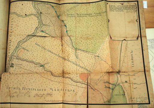
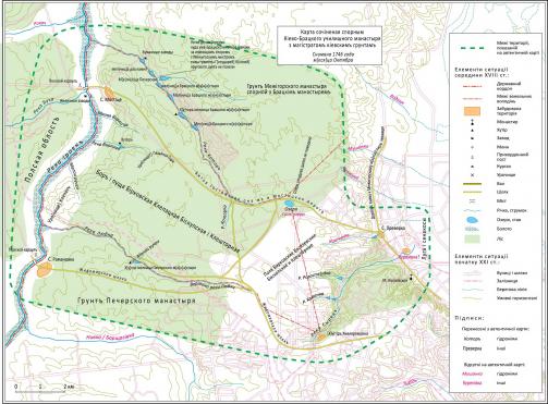
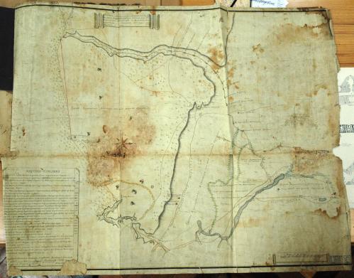
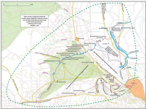
We discuss two mid-18th century maps of the north-western suburbs of Kyiv. These maps enter academic circulation for the first time. They are a valuable source for all who study Kyiv’s historical topography.
Map 1746 (general view)
Map 1746 (reconstruction)
Map 1752 (general view)
Map 1752 (reconstruction)
Published: Journal of Geodesy and Cartography (Kyiv, in Ukrainian), 2015, Number 4 (97), p. 38 – 43. The article was received on June 11, 201.
Maps in full resolution
Maps photographed with resolution 6 megapixel (total 13 files):


 11.74 Mbytes